
TL;DR

Get business pricing on monitors, keyboards and dev gear
- Business-only prices and quantity discounts
- Tax-exempt purchasing
- Multiple users, one account, clear invoices
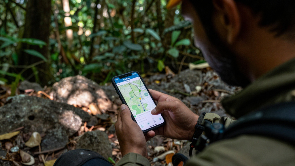
CoMaps is an offline mapping application that has been successfully used by rescue teams in Venezuela to navigate remote areas without signal. This development highlights a significant advancement in emergency response technology for regions with poor connectivity.
Rescue teams in Venezuela have successfully used CoMaps, an offline mapping application, to locate and assist stranded individuals in remote areas where cellular signals are unavailable. This marks a significant step forward in emergency response capabilities in regions with poor connectivity, where traditional GPS and communication tools often fall short.
The CoMaps app was deployed during recent rescue missions in Venezuela’s inaccessible regions, where cellular signals are frequently disrupted. According to officials involved in the operations, the app enabled rescuers to navigate rugged terrain, identify safe routes, and coordinate efforts without relying on internet or cellular networks. The app’s offline functionality, combined with detailed topographical maps, proved crucial in these efforts. The Venezuelan government and humanitarian agencies have confirmed that CoMaps was instrumental in saving lives during these incidents, marking its first widespread operational success in the country.Developed by a team of technologists and emergency responders, CoMaps is designed specifically for use in areas with limited or no network coverage. It stores detailed maps locally on devices, allowing users to access navigation data even when offline. The app also integrates GPS tracking, enabling real-time location sharing among rescue teams. The recent deployment has garnered attention from international aid organizations, which see it as a potential model for disaster response in other connectivity-challenged regions.
Impact of CoMaps on Emergency Response in Venezuela
The successful use of CoMaps in Venezuela demonstrates how offline navigation technology can transform emergency responses in areas with unreliable communication infrastructure. It reduces dependency on cellular signals, which are often disrupted during natural disasters or in remote locations, thereby increasing rescue efficiency and safety. This development could lead to broader adoption of offline mapping tools in disaster-prone regions worldwide, potentially saving more lives during critical moments. Additionally, it highlights the importance of technological innovation tailored to local infrastructural challenges, encouraging further investment in such solutions.
offline GPS navigation app for Android
As an affiliate, we earn on qualifying purchases.
As an affiliate, we earn on qualifying purchases.
Venezuela’s Connectivity Challenges and Emergency Response History
Venezuela has long faced significant challenges with its telecommunications infrastructure, especially in remote and rural areas. Frequent power outages, economic instability, and natural disasters such as floods and landslides have strained emergency response systems. Historically, rescue efforts have relied heavily on radio communication and paper maps, which are often outdated or impractical in rugged terrain. In recent years, efforts to modernize emergency tools have included satellite phones and portable GPS devices, but these solutions have limitations in coverage and usability. The deployment of CoMaps represents a notable shift toward leveraging digital technology tailored for offline use, addressing long-standing gaps in rescue operations.
Prior to this, some NGOs and local authorities experimented with basic offline GPS apps, but none achieved widespread operational success until now. The recent rescue missions confirm that dedicated offline mapping solutions can significantly enhance rescue efficiency and safety in Venezuela’s challenging environment.
“Our goal was to create an app that works offline, with detailed maps that can guide rescuers in the most challenging terrains.”
— Carlos Mendoza, developer of CoMaps
portable GPS device for rescue teams
As an affiliate, we earn on qualifying purchases.
As an affiliate, we earn on qualifying purchases.
Uncertainties About Broader Adoption and Future Use
While CoMaps has proven effective in recent rescue efforts, it is still unclear how widely the app will be adopted across Venezuela or in other countries facing similar challenges. Details about the app’s scalability, user training, and integration with existing rescue protocols remain limited. It is also not yet confirmed whether the government or international agencies will invest in expanding its deployment beyond initial cases. Furthermore, questions linger about the app’s performance in extreme weather conditions or larger-scale disasters, which could test its robustness and reliability.
rugged handheld GPS for outdoor use
As an affiliate, we earn on qualifying purchases.
As an affiliate, we earn on qualifying purchases.
Next Steps for CoMaps Deployment and Validation
Rescue agencies and developers plan to conduct further field tests in different regions of Venezuela to assess CoMaps’ performance in various scenarios. There is also ongoing discussion about integrating the app into formal emergency response protocols and training programs. International aid organizations are monitoring these developments and may support broader distribution if results continue to be positive. Additionally, further technical enhancements, such as offline data updates and improved user interfaces, are expected to be prioritized to increase usability and effectiveness in future operations.
satellite phone for emergency communication
As an affiliate, we earn on qualifying purchases.
As an affiliate, we earn on qualifying purchases.
Key Questions
How does CoMaps work without an internet connection?
CoMaps stores detailed maps locally on the device, allowing users to navigate and access geographic data without relying on cellular or internet signals. It uses GPS for real-time location tracking, which does not require an active network connection.
Who developed CoMaps and is it available for other regions?
CoMaps was developed by a team of technologists and emergency responders specifically for use in areas with limited connectivity. Currently, its deployment has been limited to Venezuela, but the developers are exploring options for broader regional or global use.
What challenges might limit the app’s effectiveness?
Potential challenges include the need for initial device setup, training for rescue personnel, and ensuring up-to-date map data. Extreme weather conditions or large-scale disasters could also impact GPS accuracy and device functionality.
Will the government support wider adoption of CoMaps?
It is not yet clear whether Venezuelan authorities will formally endorse or fund the app’s broader use. Current efforts are primarily driven by NGOs and the app’s developers, with discussions ongoing about integration into official rescue protocols.
Source: hn
Columbus Day / Indigenous Peoples' Day Picks
long weekend sales
As an affiliate, we earn on qualifying purchases.